

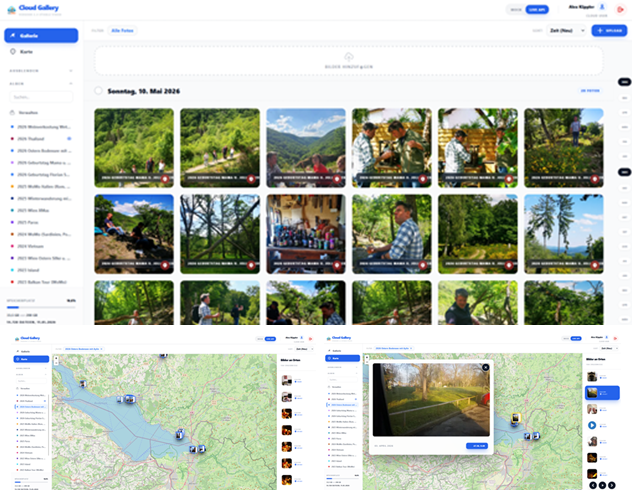
In early 2026, as AI continued to encroach further into our daily lives, I realized just how digitally dependent I had become. For this reason, I decided to stop storing my photos exclusively in the Google Cloud and instead set up my own private version of „Google Photos.“
Using AI and „vibe-coding“ (via Google AI Studio), I generated a Google Photos-like application through prompting. The frontend—that is, the look and feel—bears a resemblance to Google Photos, but is enhanced with features I had previously built years ago using Couno. This allows galleries to be easily shared with others (including the assignment of read/write permissions) and features a map view where I can display photos chronologically based on their embedded geo-coordinates. In presentation mode, I can thus relive those experiences while simultaneously seeing on the map exactly where they took place.
I did not entrust the backend (storage and data management) to the AI; it is written in PHP and essentially functions as a comprehensive API.
The same applies to the Android app—which facilitates the direct transfer of photos to the gallery (both automatically on a schedule and manually)—which I coded myself, albeit with the assistance and partial support of Google AI Studio.
To achieve greater digital independence, I host this entire „architecture“ on a Raspberry Pi 5 equipped with two hard drives, running within a private local environment—meaning no external cloud services and no recurring costs.


 The “AEM 6 Business Practitioner” exam was successfully completed in December 2016. The Business Practitioner certificate teaches the basic functions, use, structural design and options of the individual tools of the Adobe Cloud solution, in particular the CRM “Adobe Experience Manager”.
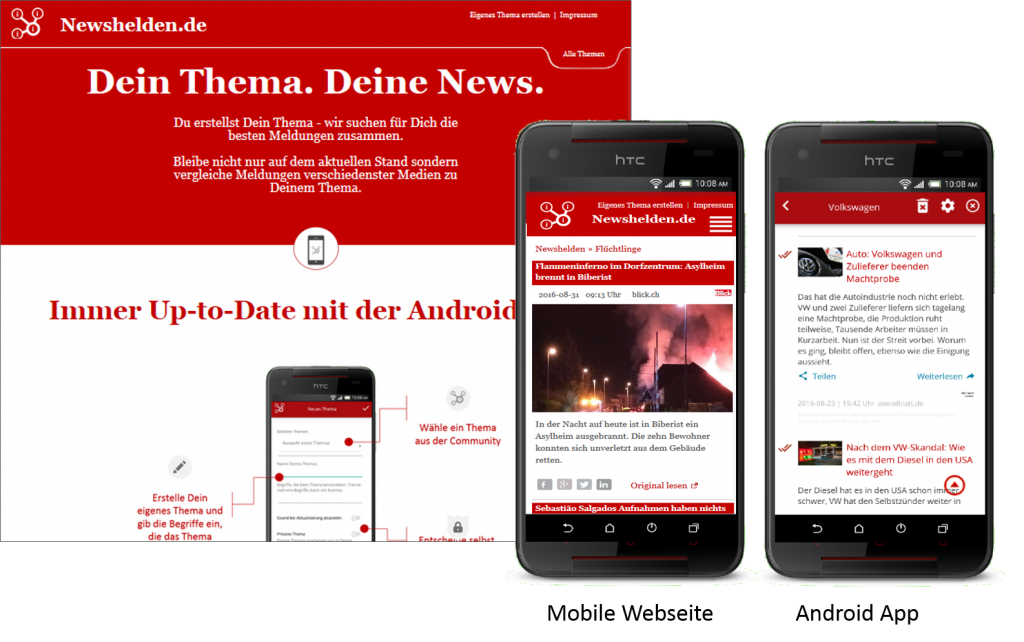


 Couno.de is a platform, in which different users can upload media (pictures, videos) from an event, they visited together. This time, everybody shares its videos and pictures, but couno.de joins them again, to get a wider view onto an event, with the pictures of everybody joined in on the platform. The platform is able to track the geo-coordinates of the images so it becomes possible to plott a complete journey with map-display and innovative presentation-mode. To make the upload as easy as possible, I created a Java-Upload-Tool for desktop-PC and a native android app.[bis]today[/bis]


